Extreme heat events have sent temperatures rising to a whopping 24 degrees above the average for this time of year. Could this potentially mean a much warmer August is on the cards for Ireland?
An intense heatwave, which has seen temperatures on the continent reach past 40 degrees, is set to make its way to Ireland.
Met4cast tweeted: "Antarctic heatwave! Temperatures are some 24C above average in northern Antarctica at the moment in what should be the height of winter.’
Discussing how the sweltering temperatures have impacted Western Europe, severeweather.eu wrote: "Temperatures exceeding the +40 °C threshold across parts of France and close to +45 °C in Spain again."
For the end of July and start of August, temperatures will be much above average across Southern and especially Western Europe, with the potential for it to push further north towards Ireland and the UK thanks to a "heat dome."
According to severeweather.eu, a heat dome is a ‘feature that leads to these extreme heat events. Usually, the heat dome is the main and the most dominant feature of summer weather patterns in Europe and North America.’
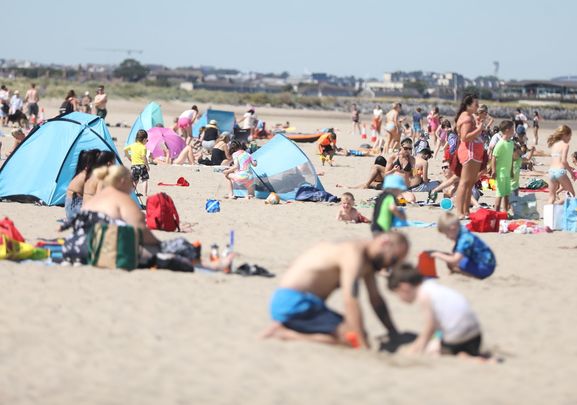
Ireland has struggled throughout the summer months with inconsistent conditions, with many hopeful a big bout of sun could soon be upon us.
However, this weekend will see the potential for heavy rain nationwide, with a few clear spells in the mix, according to Met Eireann.
There’ll be a mix of sunny spells and patches of rain and drizzle come Friday.
"A spell of heavy rain will move in across the western half of the country by late morning, extending eastwards through the afternoon.
"A clearance to sunshine and isolated showers will follow to western areas, extending nationwide during the evening.
"Highest temperatures 17 to 23 degrees in fresh and gusty southerly winds, warmest in the east.
"Largely dry on Friday night with long clear spells and just a few showers in western and northwestern coastal areas. Cooler than preceding nights with lowest temperatures generally of 8 to 11 degrees in moderate southwest breezes.’
"A mix of cloud, sunny spells and scattered showers on Saturday. The showers will become confined to western and northern coastal counties by evening with plenty of sunshine around the country by then.
"Highest temperatures of 16 to 19 degrees in fresh and gusty southwest winds. Largely dry early on Saturday night with clear spells but cloud will thicken from the southwest overnight bringing some patchy rain to the west and north by the end of the night. Lowest temperatures of 10 to 13 degrees in moderate southwest winds.
"Mostly cloudy on Sunday with scattered outbreaks of rain and drizzle across the country in the morning. Heavy and persistent rain will then develop in many areas during the afternoon and evening but some southeastern parts may escape largely dry.
"Localised flooding is possible across parts of Connacht and west Ulster. Highest temperatures of 15 to 18 degrees in moderate to fresh southerly winds. Further spells of heavy rain on Sunday night with the continued chance of spot flooding. Humid with lowest temperatures of 14 to 17 degrees in fresh and gusty southerly winds."
* This article was originally published on Extra.ie.


Comments