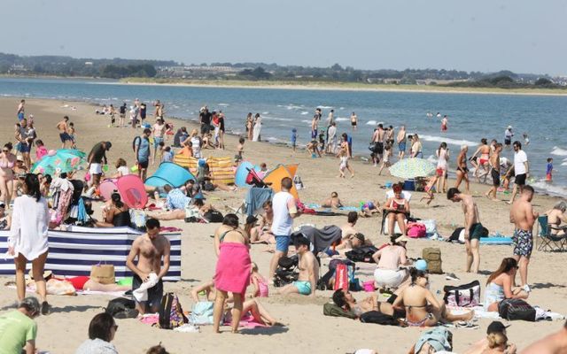
Weather maps have pinpointed the exact date that the sun will return to Ireland alongside temperatures of 26C following a very mixed August so far.
In recent weeks, Ireland has had to brace for several weather warnings, with the most recent coming into effect yesterday, August 23, as storm Lilian made landfall, causing spot flooding and severe winds nationwide.
Thankfully, Weather Forecaster WX Charts has predicted that Friday, August 30, will see temperatures across the country spike, a welcome change following unseasonable conditions in recent weeks.
However, the latest weather maps predict that the East Coast will receive the best conditions, with the mercury set to soar past the 20C mark next week.
The current weather maps show that temperatures will range from 20C to 26C, with Leinster counties such as Kildare, Offaly, Laois, Carlow, and Kilkenny set to bask in the hottest conditions as September approaches.
The weather models are subject to change, but predictions for the last week of August look promising after a summer mainly dominated by damp conditions.
Met Éireann has also released its long-range forecast as summer turns to autumn. It predicts that we could have a final few days of hot weather before things turn cooler.
The National Forecaster has said that the weather looks unsettled between August 26 and September 1. Low pressure in the Atlantic Ocean will dominate the weather for most of the week.
They said: "Frontal systems will spread from the southwest as a result, bringing spells of rain and breezy conditions at times.
"Rainfall amounts will be slightly above average nationwide, with the wettest conditions in the west and southwest.
"Temperatures will be near normal or slightly above. Rain warnings are possible during this period."
However, maps for the first week of September weakly indicate that things could be more settled, with Met.ie explaining that high pressure will have more control of Ireland’s weather once the new month rings in.
They said: "High pressure will have more of an influence over our weather, bringing drier-than-average conditions for most. However, occasional showers and outbreaks of rain cannot be ruled out. Mean temperatures will be around normal."
There is some uncertainty between Monday, September 9 and Sunday, September 15. Current trends indicate that the weather will become more variable during this time, with temperatures staying roughly normal for the time of year.
"A southwesterly airflow is signalled to become established, bringing rain and showers from the Atlantic," the national forecaster shared.
"It will be somewhat wetter than normal in the southwest as a result. Rainfall amounts will be around normal for the rest of the country with the exception of the northwest and north, where rainfall will be slightly below average."
Additionally, they discovered that current trends indicate that Ireland’s weather will be generally unsettled between Monday, September 16, and Sunday, September 22.
Low pressure frequently affects the country and brings wetter-than-usual conditions nationwide. The temperature is set to stay at the average for autumn.
*This article was originally published on Extra.ie.


Comments