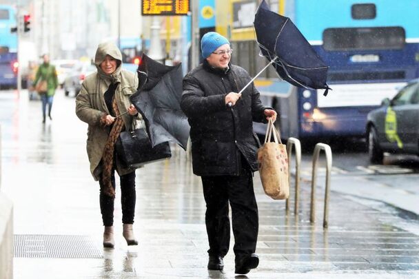
Storm Bert has been named as the second storm of Ireland’s 2024/2025 season, Met Éireann announced today, Thursday, November 21.
Storm Bert will bring “much wetter and windier” weather to Ireland over the coming days.
An advisory has been issued for Ireland, together with a nationwide yellow wind and rain warning for Friday night, November 22 into Saturday, November 23 which Met Éireann says will be the start of Storm Bert.
The naming of Storm Bert comes while Ireland is already under a number of weather warnings.
Storm Bert has been named by Met Éireann. ⚠️
Becoming very wet and windy on Friday night, with further spells of strong winds and heavy rain over the weekend.
Stay up to date on https://t.co/dz6JbE5FIb #StormBert #MetÉireann pic.twitter.com/daVQZ1jo2v
— Met Éireann (@MetEireann) November 21, 2024
Explaining why they named the upcoming storm over Ireland, Met Éireann said: “Bert is a low-pressure system currently forming in the Atlantic. When it moves closer to Ireland it will displace the current cold Arctic air introducing very strong winds and heavy rain."
Met Éireann said that at the moment, potential impacts from Storm Bert include localized flooding, dangerous traveling conditions, displaced objects, and fallen trees.
Main impacts from Storm Bert are expected on Saturday and Sunday, but there’s potential for lasting impacts into early next week.
Met Éireann said on Thursday that they are closely monitoring the situation and will provide updated information as its high-resolution model (two days ahead) gives more detailed information.
Storm Bert - Meteorological Situation
This weekend, Storm Bert will move close to Ireland, displacing the recent cold Arctic airmass, Met Éireann said on Thursday.
Very strong winds and heavy rain will track north eastwards over the country on Friday night (yellow wind and rain warnings issued nationwide), which will continue right through the weekend.
Storm Bert - Meteorologist commentary
Meteorologist Andrew Doran-Sherlock says: “Storm Bert will bring milder but very wet and windy conditions for the weekend.
"Heavy rain on Saturday and Sunday will likely lead to localised flooding in urban areas and some river catchments particularly in the west and southwest, as this rain is falling on already saturated and waterlogged ground.
"We are monitoring the situation closely and will upgrade/issue warnings as Met Éireann’s high-resolution model (which provides information two days ahead) is analysed.
"There’s strong likelihood of Status Orange wind warnings in western and northwestern counties. The impacts from Storm Bert will commence later on Friday and will continue through the weekend and potentially through early next week as well.”
Storm Bert - How to stay safe
Stay up-to-date with the forecast and the warnings for your county on met.ie, the Met Éireann app or Met Éireann socials (@meteireann).
Check in with your local authority and emergency management stakeholders (Irish Coast Guards, Gardaí, etc) via their websites and social channels to see how your area will be/is affected.
Ensure your mobile phone is fully charged to enable communication in advance of Storm Bert, and keep local emergency numbers in your phone.
Keep a small amount of food, medical, and water supplies in case it’s dangerous to step out of the home.
Regarding flooding, you can consult Ireland's Office of Public Works (OPW's) flood maps, which show areas that may be at risk of flooding based on historical data.
Stay away from coastal areas during the period. Remember the advice from the Irish Coast Guard: “Stay Back, Stay High, Stay Dry."
Don’t try to walk, cycle, or drive through flooded areas, the depth of the water can be deceiving.
Remember: As little as 150mm of fast-flowing water can knock you off your feet and 300mm of fast-flowing water can move most cars off the road.
While on the road in strong winds, beware of fallen trees or other debris and high-sided vehicles, particularly when overtaking. If you are driving a high-sided vehicle, try to anticipate exposed sections of roadway where winds will be stronger.
ESB Networks is highlighting the dangers posed by fallen live wires and advises the public and the emergency services to stay away from fallen cables and to report such cases immediately. ESB Emergency Services can be contacted at 1800 372 999.
You can monitor www.powercheck.ie in regards to power restoration times
“Be Winter Ready”: Follow recommendations before, during and after the event on gov.ie – Be Winter Ready (www.gov.ie)


Comments