Taken from the July / August 2019 issue of Ireland of the Welcomes magazine. Subscribe to this bi-monthly print magazine here.
“As I was going over, the Cork and Kerry mountains…” goes the song Whiskey in the Jar. Even in the absence of a money-counting Captain Farrell and a lovelorn highwayman, a journey over the Caha Mountains of the Beara Peninsula makes for unforgettable memories.
The Beara peninsula, which straddles the counties of Cork and Kerry, suffers somewhat from middle child syndrome. The third of the five great peninsulas of Ireland’s southwest, it’s usually overshadowed by the celebrated Dingle Peninsula and, home to the famed Ring of Kerry, the Iveragh Peninsula. The two junior peninsulas to the south, Sheep’s Head and Mizen Head, rock a remote West Cork bohemian vibe. Beara is the shy, slightly awkward one, neither Cork nor Kerry, neither touristy nor artsy and all the more worthwhile for it.
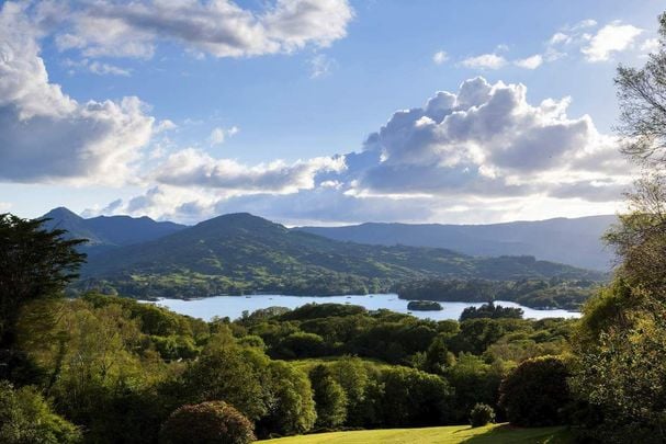
Part of the problem for Beara is that getting there is a challenge. The journey either involves a long drive from Cork City, bypassing lots of spectacular scenery along the way or a hair-raising drive from Kerry, along serpentine roads climbing through either one of two lonely passes over the Caha Mountains. Beara demands visitors make an effort, and for those brave enough to tackle the route from the Kerry side and cross those storied mountains, the reward is a breathtaking view of the two counties that make up Beara and the Atlantic Ocean that lashes its coast.
The Caha Pass
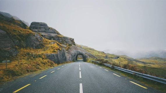
The Caha Pass.
The Caha pass is probably the easier of the two routes from the Kerry side. It links the towns of Kenmare in Kerry to Glengarriff in Cork and it was quite a feat of road making in its day. It features two tunnels both of which were blasted out of the rock in the middle of the 19th century and then hand-hewn. The mountain track was turned into a paved road in the early 1900s by a Galway motor-enthusiast called Richard Mecredy. But even today the tunnels are too low for most tour buses to pass through which reduces traffic along the route significantly in peak season. About 70 meters into the longer tunnel is the border between Kerry and Cork, no passport is required.
Even in summer, this is a lonely road with just a few locals and the odd hire car about. It’s all lush green slopes and mushy bog-land on the Kerry side changing to the rougher and rockier ground at the peak and on into County Cork. On a cloudy day, the sense of isolation nearing the summit lends the area a spooky air. It’s not difficult to imagine why, in ancient times, Druids used this place for ‘cursing’ purposes, even installing a ‘cursing stone’ to wish ill on their enemies. It’s also the most likely setting for the song Whiskey in the Jar, about a highwayman who himself was robbed by Jenny, his wayward lady love. Absent a paved road and the area becomes even more inhospitable, an ideal spot for skulduggery.
Sailing down from the summit into County Cork, the pale blue waters of Bantry Bay spread as far as the horizon and, nestled in a thick wooded glen lies the village of Glengarriff. Once home to Hollywood legend Maureen O’Hara, Glengarriff is a relaxed unpretentious spot, which has long been a popular holiday town. The poet William Butler Yeats was a regular visitor back. Comprising not much more than a single street and a population of just 800 people out of season, it’s well-stocked with hotels, hostels, restaurants, cafés and, of course, pubs, most of which have music in the evenings. As a base for exploring Beara, it’s ideal.
Garinish Island
Just a stone’s throw from Glengarriff’s main street, and surrounded by lush woodland, is the Blue Pool, a small natural harbor formed where river meets the sea of Bantry Bay. The Blue Pool is a verdant oasis, sheltered by the Caha Mountain range and bathed in the warm waters of the Gulf Stream, which originates in the Gulf of Mexico, creating a sub-tropical style climate. Further out on Bantry Bay lies Garinish Island, an extraordinary garden island that takes full advantage of the balmy conditions.
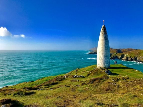
View of Bantry Bay.
The ferry to Garinish leaves from Blue Pool and should take less than 20 minutes. But there’s Seal Island to admire first, or rather there’s a cluster of basking rocks peeping above the water and usually topped by some very chilled Harbour seals who aren’t just used to passing boats but relish any attention coming their way. There’s a colony of about 250 seals on the way to Garinish so it’s impossible not to capture several flapping in and out of the water and generally preening for the camera.
The Irish name for Garinish is Oileán na Chulinn meaning island of holly so it’s likely it has long been revered. To the ancient Druids, the Holly was second only to the oak in terms of magical powers.
The story of modern-day Garinish begins in 1910 when a Belfast businessman Annan Bryce bought the island from the British War office. Bryce and his wife Violet, both keen horticulturists, wanted their new island home to become a botanical paradise. They commissioned Harold Peto, at the time a leading architect and garden designer, to draw up plans for a mansion and fashion around it a new Eden. The mansion was never built but the island garden, which Peto and the Bryces created, is truly heavenly.
Surrounded by lapping sea, with the stony barren slopes of the Caha mountains in the distance, the elegant manicured beauty and rich green hues of Garinish are preternatural. Plants, shrubs, and trees that should never survive in the Irish climate surround soft grassy paths that wind across the island via the ornately decorated terraced pond, a series of viewing platforms over the ocean, a walled garden, a carefully preserved Martello Tower. Around every twist or turn of the path is a new delight, whether it’s an intricately carved statue or a series of huge blossoms from an unfamiliar tree. Garinish has been carefully crafted to seduce the senses regardless of the season with rhododendrons and azaleas dominating in spring and ceding to climbers and perennials as summer sets in.
Today Garinish is managed by the Irish Office of Public Works and features a coffee shop and restrooms.

Are you planning a vacation in Ireland? Looking for advice or want to share some great memories? Join our Irish travel Facebook group.
The Healy Pass
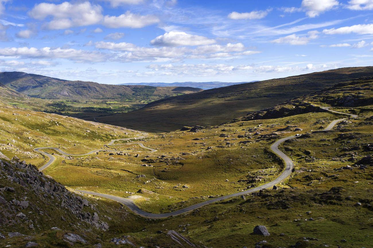
The Healy Pass.
It’s been described as one of Ireland’s greatest drives, and is certainly as dramatic as it is dangerous. The Healy Pass runs from Adrigole Bridge in County Cork and winds its way over two of the highest peaks of the Caha range before descending to Lauragh Bridge in County Kerry. On a clear day the scenery is spectacular. But fog and mist descend quickly in these parts and, with a seemingly never-ending series of hairpin bends climbing through desolate boggy marshland, caution is advised.
The Healy Pass owes its existence to one of the most heartbreaking periods of Irish history. In 1847, it was one of the famine projects on which the British government insisted hungry people must labor before being provided with food. Back then it was a bridleway or horse riding path known as Bealach Scairt, or Way of the Sheltered Caves, which suggests that laborers at least found places to take cover when weather conditions deteriorated during the works.
It was upgraded in the early 1930s and renamed the Healy Pass after a Bantry-born politician who became the first Governor-General of the ‘free state’ of Ireland, as the country was known after the Anglo Irish Treaty of 1921. Tim Michael Healy had originally been a member of the British parliament and a fierce supporter of Charles Stewart Parnell and the Irish Parliamentary Party. But he famously led the heave against Parnell when the party leader’s long-term relationship with Catherine O’Shea came to light. Catherine O’Shea was married if estranged from her husband and Parnell’s association with her caused outrage both in Victorian Britain and pious Ireland. The story goes that Parnell fighting for his political life asked his parliamentary party colleagues: “Who is the master of the party?”. Healy retorted. “Aye, but who is the mistress of the party?”
Healy stepped down as an MP during the general election in December 1918, making way for Sinn Féin to take his seat. He disappeared from political life, only to be asked back by the newly minted Irish government in 1922 to take up the post of Governor-General, effectively the British King’s representative to the Irish state, which still pledged allegiance to the British monarchy.
From the Cork side, the climb to the peak begins slowly enough across open bog, before an ever more dizzying series of twists and turns mark the ascent to more than 1,000 feet above sea level. Along the road and dotted throughout the otherwise empty marsh ground are local sheep. At the very top is a statue of Jesus on the cross, gazing down at the vast and empty valley below.
Cresting the summit marks the passage from Cork into Kerry and a surprisingly dramatic change of landscape. Instead of endless miles of barren bog, this side of the mountain is forested with a series of lakes in the valleys and the sea in the distance. Descending further and the hedgerow, meadows, and pretty stone bridges complete the sense of arriving not just in another county but an entirely different country.
Castletownbere
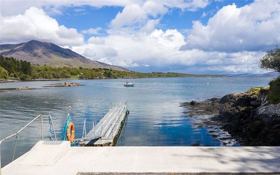
Castletownbere.
If the Beara Peninsula has a capital it is Castletownbere, or the Castle Town of Beara as it’s known in Irish. This is a bustling little town and a busy fishing port. Aside from a plethora of fish restaurants it also boasts some excellent bars including McCarthy’s Bar made famous by the English writer Pete McCarthy who wrote about it in the best-selling book McCarthy’s Bar.
Comments